The prime directive of the ITC is to increase the efficiency and accessibility of long range transportation systems and municipal infrastructure for the world at large. Simultaneously, we must ensure the longevity of existing institutions and insure that new opportunities exist for the coming generations.
With 100 years of aviation under the belt of human experience, we have come to know very powerful and multifaceted aircraft, the advent of modern rocketry and space flight.
Yes, we live in exciting times!
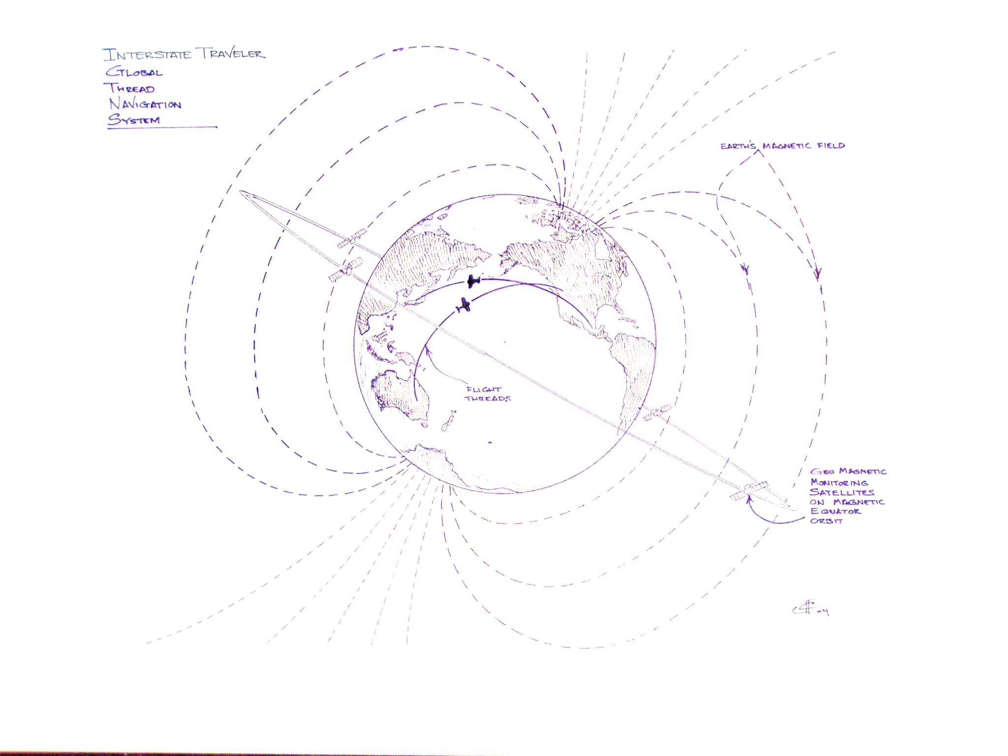
The ITC Global Thread Navigation System (GTNS) is a proposal to create a globally standardized and unified aerospace management tool that will allow for an automated navigation and collision avoidance system to facilitate a virtually infinite number of aircraft reliably and safely traveling optimal trajectories with virtual certainty that collision with another aircraft would be next to impossible.
The computer controlled GTNS generates a virtual thread in space connecting the point of launch and point of landing of an aircraft/spacecraft/watercraft/etc. with one simple rule:
Much like yarn wrapped around a yarn ball is always overlapping the threads underneath it and never truly intersects the other threads. This layered thread effect gives the GTNS aerospace computer the chore of weaving these threads using rather simple equations to constantly monitor potentially millions of air craft simultaneously and reliably.
Using the computational power available in computers available off the shelf, the ITC GTNS will provide for thread management of air craft and also make it easier to manage "restricted" airspace, and also reserve certain layers in the atmosphere much as it is done today.
The thread generation process allows threads to cross paths as long as the vehicles on the respective threads do not have the potential of arriving in the same space at the same time.
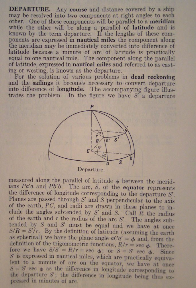
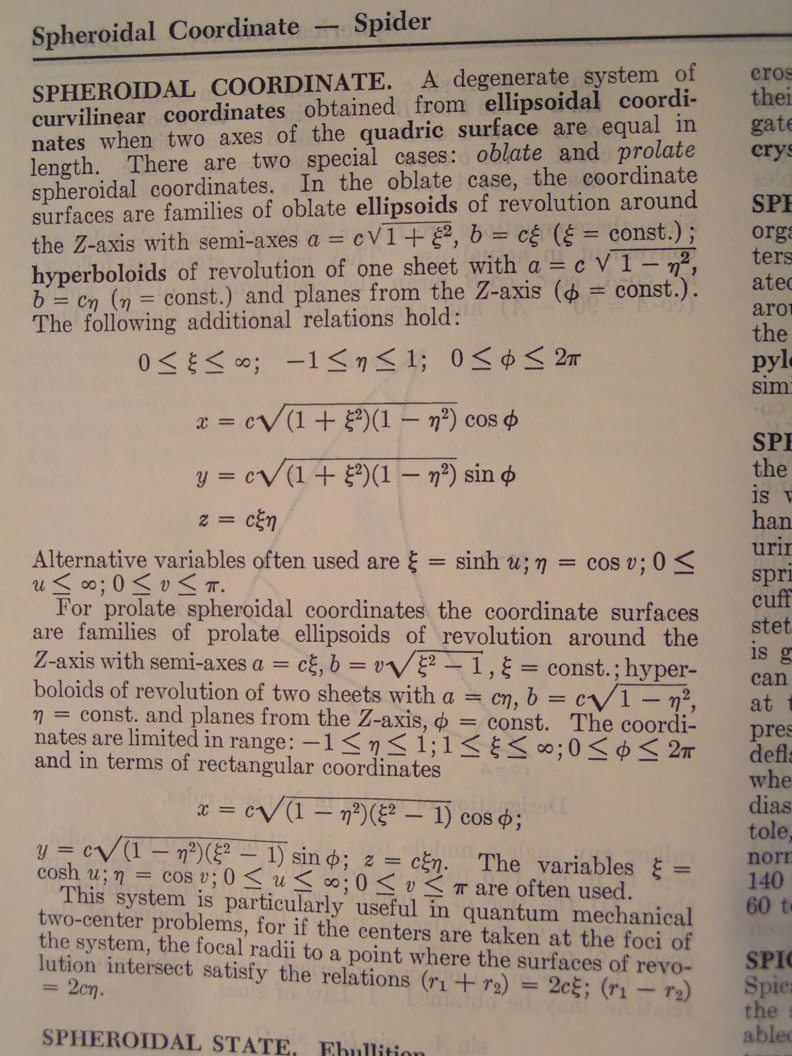
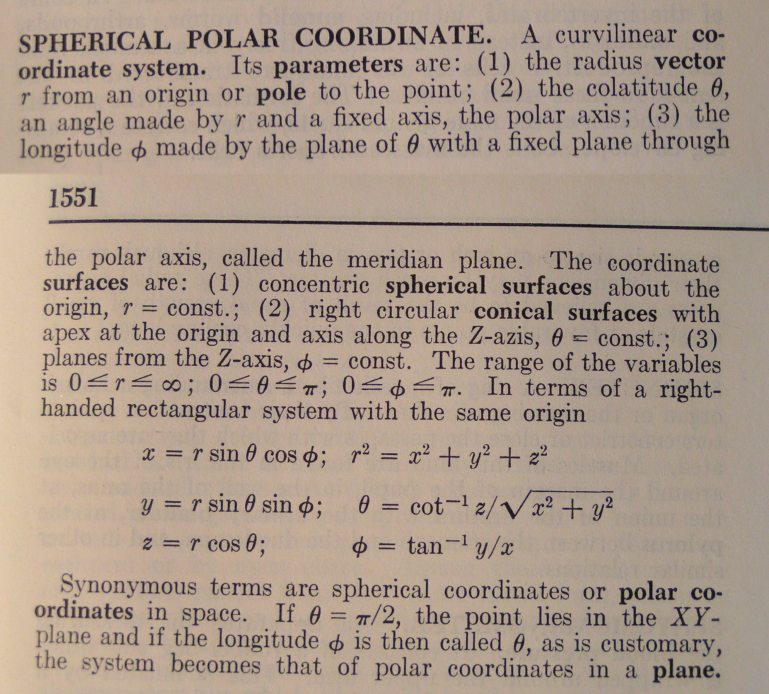
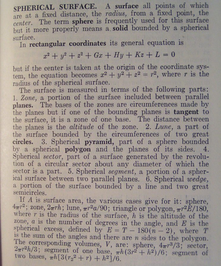
To demonstrate the simplicity of this computer generated "Flight Thread" navigation system, I have attached images of text book references to the several types of proven mathematical equations that will allow the computers to calculate millions of threads simultaneously, following the rules as stated above.
The one device required to enable the ITC GTNS is a single point of reference either physically rendered or virtually calculated by co-location of three or more physical devices in a similar manner as the existing Global Positioning System can estimate a combined longitudinal and latitudinal co-location. This 'device' being a single point of reference, the ITC GTNS is designed to use this 'device' as a virtual point of origin for spherical measurements. The location of this single point of reference is rendered by measuring the Earths magnetic Field with three or more terrestrial stations or orbiting satellites where the stations/satellites mathematically derive the central point of the Earth's magnetic field.
We consider this method to be the most reliable in the event of a geo-magnetic polarity shift as has been noted in the geologic record to occur at regular intervals which may disable existing navigation systems.
http://helios.gsfc.nasa.gov/magnet.html The Earth's Magnetosphere.
http://helios.gsfc.nasa.gov/solarmag.html The Sun's Magnetosphere.
As an integration with the existing global cartographic methods, we identify the prime meridian at Greenwich England as the 1st degree and the International Dateline at 180 degrees as a plane bisecting the globe vertically where said plane travels through the center of the Earth rotational access. The ITC GTNS generates an electronic overlay based on the derived center of the geo-magnetic field and measures all other point calculations from the Prime Meridian.
From the center point, a progression of points are drawn at a certain distance from the center point connected to form a line or thread through space. Further, by using the virtual center of the geo-magnetic field as a cartographic point of origin, we can provide aerospace management at any position and any elevation around the world and under the sea.
Bear in mind the true novelty and Patentable Claim of the ITC GTNS is more than just the application of computing power and geometric equations: it is the fact that it is oriented on the Earth's magnetosphere yet renders reliable and consistent navigation threads regardless of the migration of the primary polar orientation of the magnetosphere which is constantly changing. More specifically, it is designed to continue to create reliable navigation threads for millions of aircraft even if the Earth's magnetosphere where to reverse polarity as it is known to have done at regular intervals of about 250,000 years. Expert geophysicists have published research stating that the last change is thought to have been about 600,000 years ago, making the inevitable polarity flip long over due. Today's navigations systems may suffer grave malfunctions if the Earth's polarity were to reverse. Either way, we should prepare for it now and take action now so as not to be caught un prepared. Experts predict a reversal within the next one or two thousand years.
http://www.phy6.org/earthmag/reversal.htm Earth's Magnetosphere Reversal.
http://www.phy6.org/earthmag/magnQ&A1.htm#q6 Reversal Q&A